


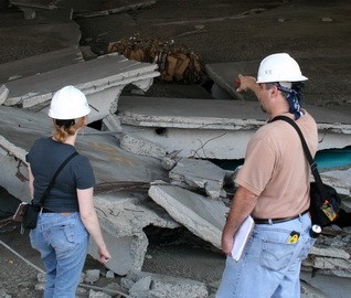


The National Park Service defines a cultural landscape as “a geographic area, including both cultural and natural resources and the wildlife or domestic animals therein, associated with a historic event, activity, or person, or exhibiting other cultural or aesthetic values.” Cultural landscapes range from abandoned coal mines to remote coastal fishing villages, historic farmsteads, urban neighborhoods, battlefields, national cemeteries, and Cold War-era missile sites, among others. Each historic site presents unique challenges in terms of assessment and stewardship. Cultural landscape studies provide a basis for the preservation and rehabilitation of the landscape and its features.
In this webinar, WJE conservator and historian Deborah Slaton, with historical landscape architects Jane Jacobs and Liz Sargent, provide an overview of cultural landscapes and the approaches used to evaluate, document, and develop treatment recommendations for these significant historic places.
By the end of the webinar, you will be able to:
- Describe the types of natural and cultural resources that may be encountered in cultural landscapes
- Identify examples of cultural landscapes to illustrate the wide variety of sites for which studies may be prepared
- Differentiate between cultural landscape reports and cultural landscape inventories
- Explain some of the challenges encountered in the preservation of cultural landscapes today
more to learn
View this webinar in our interactive audience console to earn 1 AIA learning unit, access related resources, submit questions to the presenters, and download a certificate of completion.
LIZ PIMPER
Hello everyone, and welcome to today's WJE Webinar, Preservation Approaches for Cultural Landscapes. My name is Liz Pimper, and I'll be your moderator. During the next hour, WJE conservator and historian, Deborah Slaton, and historical landscape architect, Liz Sargent, will provide an overview of cultural landscapes, and the approaches used to evaluate, document, and develop treatment recommendations for these significant historic places.
Historical landscape architect Jane Jacobs will join Deborah and Liz to answer questions at the end of the hour. This presentation is copyrighted by Wiss, Janney, Elstner Associates. And now, I will turn it over to historic preservationist, Kyle Normandin, to introduce our presenters in more detail. Kyle.
KYLE NORMANDIN
Thank you, Liz, and good afternoon, and thanks everyone for attending today's webinar entitled Preservation Approaches for Cultural Landscapes. Today, we are excited to bring you this webinar. My name is Kyle Normandin and I'll be introducing our speakers. I'm currently a principal in our WJE New York office, and I'm also the coordinator for in-house historic preservation technical resource group. As many of you know, cultural landscapes range in a variety of typologies from abandoned coal mines to remote coastal fishing villages, historic farmsteads, urban neighborhoods, battlefields and national cemeteries to name a few. Each historic preservation site presents unique challenges in terms of their assessment and stewardship. We have three prominent speakers today with recognized expertise and many years of experience in this field, historian and conservator Deborah Slaton, together with historic landscape architects, Liz Sargent and Jane Jacobs will provide an overview of cultural landscapes and the approaches used to evaluate, document and develop treatment approaches for these significant historic places.
And now just a brief introduction on our speakers. Deborah Slaton, FAPTE is a principal with Wiss, Janney, Elstner Associates specializing in historic preservation materials conservation. She regularly collaborates with WJE project teams on historic structures, reports and other preservation studies and with Liz Sargent and Jane Jacobs on cultural landscape studies. She's an author of the National Park Service Preservation Brief on Historic Structures Reports and co-author of the Preservation Brief on Historic Concrete. Liz Sargent, FASLA is principal of Liz Sargent HLAA landscape architecture and historic preservation firm based in Charlottesville, Virginia. Liz has co-authored more than a hundred cultural landscape reports, cultural landscape inventories and cultural landscape assessments for historic sites around the country. Liz has been working with Deborah Slaton and Jane Jacobs on cultural landscape projects throughout the United States for over 20 years.
And finally, Jane Jacobs is a historic landscape architect with more than 25 years of experience practicing landscape architecture in Kentucky, South Carolina and Virginia specializing in preservation of cultural landscapes and master plans for historic sites. She has been working with Deborah Slaton and Liz Sargent on cultural landscape reports in many states as well as the US Virgin Islands for the past 17 years. Both Liz and Jane are also affiliated consultants with WJE. And now briefly I just want to say a few words on our learning objectives. Hopefully by the end of this webinar you will be able to describe the types of natural and cultural resources that may be encountered in cultural landscapes. Identify examples of cultural landscapes to illustrate the wide variety of sites for which studies may be prepared, differentiate between cultural landscape reports and cultural landscape inventories, and finally explain some of the challenges encountered in the preservation of cultural landscapes today. And with that I would like to turn it over to our first speaker, Deborah Slaton.
DEBORAH SLATON
Thank you Kyle. Here's an outline of today's presentation just to give you an idea of our organization. And we'll start right off with considering the question, what is a cultural landscape? The National Parks Service defines cultural landscape as, "A geographic area including both cultural and natural resources and the wildlife or domestic animals therein associated with historic event activity or person, or exhibiting other cultural or aesthetic values." As you can see, it's a very broad definition and cultural landscapes are not a United States centric construct. UNESCO, for example, defines cultural landscapes as the, "combined works of nature and of man". And the Cultural Landscape Foundation, a nonprofit supporting preservation of cultural landscapes says, "Cultural landscapes provide a sense of place and identity."
There are four non mutually exclusive types of cultural landscapes. An historic site, which is a landscape significant for its association with an historic event, activity or person. Historic designed landscape, which is a landscape significant as a design or work of art, which was consciously designed and laid out according to recognized style or tradition, or which has significant historical associations such as the National Cemetery shown here. Historic vernacular landscape, a landscape whose use, construction or physical layout reflects traditions, customs, beliefs or values or the cultural features of the people who live there. And ethnographic landscapes, which contain a variety of natural and cultural resources that are associated with a people who define the landscape as heritage resources.
There are also several types of cultural landscape studies. Cultural landscape reports are preservation planning documents that provide historical and environmental context, identify significance and integrity, identify character defining features, document and assess existing conditions and provide recommendations for treatment. Cultural landscape inventories are evaluated inventories of landscapes having historical significance. They're similar in some ways to cultural landscape reports that are developed in a special format for use in a database. Related studies include historic structure reports, which are sometimes prepared in conjunction with cultural landscape studies, as well as National Register nominations, Historic American Building Survey, engineering record and landscape survey documentation, various types of historic preservation and conservation planning documents, architectural structural and geotechnical studies and design and construction documents for historic properties.
So let's consider for a moment the question, why would a property owner request a cultural landscape study? Many of the examples we're going to explore illustrate projects our team has completed for the National Park Service, but cultural landscape assessments such as the examples shown here are requested by private and institutional property owners and municipal and state agencies as well as by the federal government. There are many reasons owners might request a cultural landscape study to understand the history and resources of the site, to support listing in the National Register of Historic Places, to obtain rehabilitation tax credits to develop planning documents when work on a cultural landscape is anticipated, for example, to accommodate a new use or as part of preservation compliance documentation for an historic site. One of the most interesting cultural landscape studies that I've come across was a student to whom I was serving as an advisor and she wrote a cultural landscape study for tranquility base on the moon, the site where humans first landed and walked on a celestial body other than earth. That was quite an interesting project.
A myriad of disciplines are involved in cultural landscape studies. Obviously the first listed historical landscape architects are critical to this effort, but architects, engineers, historians, conservators, botanists, biologists, ecologist, archeologists, geologists and other material scientists, hydrologists, surveyors and others can be involved in these studies. And a few useful characteristics of participants in cultural landscape studies. If you like to work on these projects, you need to appreciate historic sites in nature, enjoy hiking, tolerate dangerous flora and fauna, not mind insects or inclement weather and especially like writing very long reports. So with that background I'll turn this over to Liz Sargent.
LIZ SARGENT
Thank you, Deborah. So I'm going to quickly talk about the scope and methodology for a cultural landscape report. And I will say that regardless of which of the cultural landscape types, as Debra mentioned, the historic site, historic vernacular landscape, historic designed landscape or ethnographic landscape, and also regardless of the size of the landscape, which could range from a small vest pocket urban park to country or agricultural landscapes that might span thousands of acres, the scope of work and methodology remain the same. The methodology that we use and that most firms use is based on the National Park Service's 1998 guide titled A Guide to Cultural Landscape Reports, Contents Process and Techniques. This is something you can download on the internet and they're quite useful, and will follow along with what we're talking about today. You can follow up by getting a copy of that. This remains the best source of information about how to approach cultural landscape studies in terms of both scope and methodology.
So the top bullet here. Among the first things that the team working on the study needs to figure out is the project purpose and need. Despite the fact that the scope of work and methodology for the work will follow a tried and true process, the goals of the client or the owner of the property are an essential consideration in the level of detail needed for documentation, evaluation and treatment. Thus, we start by working with the client to identify a purpose and need statement that establishes the reason why the project is being done. The team refers to the statement throughout the project to ensure that the need is being addressed throughout. The next steps that form the foundation for a cultural landscape report are twofold. Conducting archival research to learn as much as possible about the physical history of the project site, and visiting the site to conduct field investigations and understand the features present on the site today and their potential preservation needs.
For archival research, this can be among the most challenging aspects of the cultural landscape study for the interest of the team in collecting a wide range of source materials from available repositories can be a challenge. Archival research may entail review and collection of historic photographs, design drawings, maps and plans, and various types of written documents and records such as deeds, wills, inventories, administrative records and records relating to building and construction projects. Archives can include federal repositories, such as the Library of Congress and the National Archives, the owner's own records, the records in local historical society collections and courthouses. Oral history and personal interviews can also be used to supplement archival records. In terms of field investigation, this entails visiting the project area in its entirety with a base map, aerial photography, a tape measure, a notebook and a camera to record the existence of features, their size, materiality, condition, and presence in the landscape. Landscape features to be recorded are both tangible, like trees, forests, buildings and roads and intangible in the form of views and land uses.
So based on the archival research, the next step is to develop a historical narrative that organizes an understanding of the evolution of the project area in a continuous chronology, breaking down the history into a series of periods of time that reflects specific influences on development. Historic maps and photographs collected during archival research are used to illustrate the narrative. The understanding of each period is also supported by a plan prepared by the team that depicts the character and configuration of the community at a snapshot moment in time. These are known as period plans or historical base maps. Based on the field investigation, the team also prepares documentation of existing landscape conditions, providing an integrated narrative photographic and cardiographic depiction of the site as a whole as well as descriptions of each individual feature. The existing conditions documentation conveys condition issues and concerns that are anticipated to need to be addressed later in treatment.
The next step is to use the historical documentation and existing conditions narrative to establish a significance evaluation and integrity assessment that identifies a period during which the property is considered significant in American history and compares the property from what it looked like during that period to its present condition. This process is based on the methodology used to evaluate properties for listing in the National Register of Historic Places. Using the significance evaluation as a guide, the team explores the relationship of change over time in the landscape and uses this to identify landscape features and systems that contribute to that significance and those that do not. The analysis also documents, values and areas of importance in the landscape that may be to an owner or to a surrounding community that should be recognized and protected, regardless of their eligibility for listing in the National Register.
The next piece is to develop a treatment approach. The team takes the project purpose and need as well as the findings of the analysis and evaluation into consideration in devising an overall approach to treatment, which is defined as long-term management of the cultural landscape. This overall treatment approach should meet the needs of the owner as well as the identified significant resources. The approach guides the development of specific treatment recommendations. The team then prepares treatment recommendations and guidelines that outline the long-term management approach and process to be undergone to protect historic landscape features and heritage values, and also often to implement necessary new interventions such as accessible walks, interpretation, accommodating restrooms or parking or any kinds of new programmatic elements that the owner desires.
Finally, we write and edit the report and as Debra mentioned, sometimes they're quite long. I just recently submitted a 950-page document, so that's an example. In preparing these reports, they're always organized into a specific framework, and this is again documented the National Park Service Guide to Cultural Landscape Reports. The first section is called the introduction and this outlines the project purpose and need, describes the project area and summarizes the findings of the study Similar to an executive summary. The part one cultural landscape report is the foundational piece. It includes the site history, the existing conditions documentation, and the analysis and evaluation. The part two cultural landscape report is treatment.
Not all cultural landscape reports include treatment, so this will address the way in which treatment meets federal guidance in the form of The Secretary of the Interior's Standards for the Treatment of Historic Properties and Guidelines for the Treatment of Cultural Landscapes, also available online. Similar to a master plan, the treatment section can include a phasing plan and planning level cost estimates for implementation of specific recommended projects. All cultural landscape reports will also have a bibliography and may have some form of appendices. Not shown here is what's called the part three cultural landscape report, which is infrequently developed but is a useful tool. It is called a record of treatment and often includes construction documents and photographs of completed work.
As an aside, both cultural landscape inventories and cultural landscape assessments are a variation on this report structure. Cultural landscape inventories are a national park service category of report type that are entered into a national database. The way in which the information discussed above is presented follows another guiding document, the National Park Service Guide to Cultural Landscape Inventory Professional Procedures Guide. Cultural landscape assessments often do not include a treatment component, rather providing guidance on the significance of a place and what features are important. They're often a more flexible tool that can be designed based on the owner's purpose and need for the project.
In articulating landscape information, both in the site history, the existing conditions, documentation and the analysis section, we use a series of what are called landscape characteristics to parse and understand the landscape and its component parts. And so I'm going to quickly run through what those landscape characteristics are. These are also covered in the Guidelines for the Treatment of Cultural Landscapes. So natural systems and features are the environmental resources and qualities that have influenced the development and physical form of a landscape. They include the underlying land form, soils and water resources as well as attendant native plant communities such as the meadows and forests shown in this image. Spatial organization is one of the more intangible qualities or characteristics. It is the three-dimensional configuration of the landscape surface characterized by features and orientation such as the arrangement of burials, access roads and monuments. In this image of Stones River National Cemetery.
Land use addresses the principle activities in a landscape that form shape and organize it as a result of human interaction. It can include agriculture, industry, recreation, burial, and many other categories. Cultural traditions are usually learned through research. They are the practices that influence land use, patterns of division, building forms and the use of materials such as the use of public lands in our nation's capital to express our first amendment rights. In the image shown. Cluster arrangements are the location of buildings and structures in a landscape and analytical understanding of meeting behind the organization. So that can be vernacular as well as designed and it's important to look at those two different types and the way that features are arranged, because they often reflect specific cultural traditions. Circulation represents the patterns, features and applied material finishes that constitute systems of movement in a landscape so they can be vehicular or pedestrian, they can also be river travel or aviation.
Topography is the three-dimensional configuration of the landscape surface characterized by features and orientation. Topography can be relatively level and shallow, undulating or steep and challenging and representing cultural adaptations such as the terraced forms shown at Vicksburg National Cemetery on the left. Vegetation encompasses indigenous and introduced trees, shrubs, vines and crown covers as well as herbaceous materials that are planted including LA's street trees and other ornamental plantings. Buildings and structures we divide into two categories. Buildings are the three-dimensional elements constructed primarily for sheltering any form of human activity in a landscape. While structures are elements built for functional purposes other than sheltering human activities, these may be related to engineering, utilities, that kind of thing.
Views are generally defined as being expansive and panoramic prospects where naturally occurring or designed, while vistas are deliberately designed, views often meant to orient the gaze to a linear feature or a focal point. Constructed water features are built elements that utilize water for aesthetic or utilitarian purposes such as the mill race shown here, but also might be in the form of a fountain. Small scale features are the elements providing detail and diversity for both functional needs and aesthetic concerns in a landscape such as signs shown here, benches and light poles, archeological sites are the traces or deposited artifacts in a landscape that suggest former activities and uses and archeological sites are really important to the cultural landscape report and that's why we often have archeologists involved on the team.
Another of the aspects of the cultural landscape report that's essential is understanding National Register eligibility and significance of a landscape, because that is the basis for a lot of decision-making in the process. So when we prepare an evaluation, a significance evaluation, we follow the guidance afforded by the National Park Service using several documents related to the National Register of Historic Places. In particular, how to apply the National Register criteria for evaluation, which is also available online. So in using these tools, we evaluate the property using National Register evaluation criteria as listed here. The significance will be defined as the quality of significance in American history, architecture, archeology, engineering and culture present in districts, sites, buildings, structures and objects that possess integrity.
We look specifically at the way in which a cultural landscape may have been associated with events that have made a significant contribution to the broad patterns of our history, such as the battlefield images that Deborah showed earlier. That have been associated with the lives of persons significant in our past, and those might be presidents or other key figures in our history. Embody the distinctive characteristics of a type period or method of construction represent the work of a master, possess high artistic values or represent a significant and distinguishable entity whose components may lack individual distinction. And this would often be a work of architecture or work of landscape architecture or work of engineering. And then under D, it's for features that have yielded or maybe likely to yield information important in pre-history or history and specifically talks to the idea of archeology, archeological sites.
In the cultural landscape report as I mentioned earlier, it's also important to determine the time period during which the property was associated with one of the criteria and comparing it with other similar properties to determine whether it might be significant at the national, statewide or local level depending on how it compares with the other properties. Further expanding on the significance evaluation is determining in what area or areas the property is significant. The National Register recognizes several areas, including architecture and landscape architecture, agriculture, industry, engineering, transportation, and many others. These are the same criteria that are used in evaluating the significance of buildings and structures for historic structures reports, as well as National Register nominations. Evaluation of significance for a cultural landscape, similar for a building involves determination of the period of significance. The period of significance refers to the span of time during which significant events and activities occurred.
As noted, it's important for a property to retain integrity for it to be eligible for listing in the National Register. So in order to assess integrity, we follow the guidance in the National Register bulletins on how to assess the property's integrity based on seven individual considerations listed here. Integrity is judged by whether the significant features of the property are present and whether the property retains the identity for which it is significant. In terms of these aspects, location is the place where the cultural landscape was constructed or the landscape where the historic event occurred. Design is the combination of elements that create the form plan space structure and style of the cultural landscape.
Setting is the physical environment of the cultural landscape. Materials are the physical elements that were combined or deposited during the particular periods of time in which it was significant and in a particular pattern or configuration to form the cultural landscape. Workmanship is the physical evidence of the crafts of a particular culture or people during any given period in history or pre-history. And feeling is the cultural landscape's expression of the aesthetic or historic sense of a particular period of time. Finally, association is the direct link between the important historic event or person and a cultural landscape. So for each of these you look at the history of the site, existing conditions and you compare how much each of these characteristics or aspects survives in the landscape from the historic period of significance.
Finally, in looking at the aspect of treatment, we follow The Secretary of the Interior's Standards for the Treatment of Historic Properties. The Guidelines for the Treatment of Cultural Landscapes that accompany the standards provide information and examples of the application of the standards to cultural landscapes. Overall, there are four treatment approaches recognized by the Secretary of the Interior as listed here, preservation, rehabilitation, restoration and reconstruction. As noted on the National Park Service website discussing the approaches, one set of standards will apply to a property undergoing treatment depending on the property's significance, existing physical condition, the extent of documentation available and interpretive goals when applicable. The standards are intended to apply to sites eligible for listing in the National Registrar of Historic Places.
Rehabilitation is highlighted in blue because this is most often the appropriate overarching treatment approach for cultural landscapes. In part because natural landscapes are always changing and because a project's purpose and need often assumes that a contemporary change is needed to accommodate a new use. For this reason, preservation is often found to be too restrictive because it does not allow for the introduction of change. While restoration and reconstruction are often difficult to implement unless very good documentation exists to allow for an authentic and accurate implementation of restoration or reconstruction, and it can also be very costly.
For each of the treatment approaches. The Secretary of the Interior standards includes guiding principles intended to provide direction and planning for repairs, alterations and additions to the historic property, and must be followed if the owner of the property wants to employ historic preservation tax incentives as part of their preservation work. I'm going to turn it over to Deborah now to continue.
DEBORAH SLATON
The next section of our presentation is a review of some representative projects for cultural landscapes that our team has completed for the National Park Service in the southeast region. For each of these examples, we're going to briefly describe the historic site and its resources, consider the history of the site and why it is significant, the particular challenges faced and the treatment recommendations developed for each cultural landscape. And when we refer to treatment recommendations, those are the measures recommended to preserve, rehabilitate, repair, and maintain the cultural landscape or historic structures and sites therein.
Our first example is the Bottle Garden at Oakland Plantation in Cane River, Creole National Historical Park, which is located in northwestern Louisiana. The park commemorates the long and complex history of early European and exploration and settlement and the Creole culture that developed and remained evident through the mid 20th century. The Bottle Garden is a tiny 0.1 acre enclosed space that sits in front of the entrance to the main house at Oakland Plantation. The fenced space is a parterre garden defined by a central brick walk and planting beds lined with 19th century bottles. It was established by the owners based on French gardens they saw during a visit to Paris in 1891. And when the original boxwood edging was lost to a blight in the early 20th century, their descendants replaced the borders with bottles of which the family had a large collection.
These photo pairs of the live oak alley with the garden and house in the background on the left and one of the later owners of this site on the brick walk in the garden on the right with a matching contemporary view of each shows how photo Paris can inform our understanding of the evolution of the cultural landscape. We often take these during site work to match available archival images for analysis and to illustrate changes over time. Here's a site plan developed as part of the cultural landscape report for this property. Since it's a very small site, the documentation was quite detailed and referenced records of plantings from the 1820s to the present as well as an inventory of the individual bottles used to line the beds previously prepared by an archeologist.
One of the key challenges in stewardship of this site is intermittent flooding after heavy rains, and you could see some of the bottles in the left and center photos of the top row. Civil engineers working under a separate contract were concurrently developing a drainage plan for the surrounding plantation, and we were asked to develop a way to reset the bottles that would protect them and prevent them being dislodged. The lower three photos show a prototype for setting the bottles and landscape fabric developed by one of our geotechnical colleagues in WJE's Denver office, who not only provided exceptional design but constructed a mock-up in his backyard.
Our next example is Chadwell Gap Coal Mining Site in Cumberland Gap National Historical Park, which is right near the border of Tennessee, Kentucky and Virginia. The Chadwell Gap Coal mining site contains the elements of an early to mid 20th century coal mining operation. The mine closed around 1943 and the site later became part of the national park. Prior to developing the cultural landscape report, our team prepared a determination of eligibility for the site to consider it against the national criteria that Liz described earlier. The project involved extensive archival research and local and national archives. Here are a few examples of the types of documentation we found for mining sites in Virginia and West Virginia similar to this mine.
The mine inspector's report asked, "Are there any hazards evident in this mine?" And the answer was, "Nothing but general mining conditions." It's quite an amazing history. Challenges in evaluating the site and developing treatment recommendations included the remote location, rigorous hiking along steep trails, cold, bears, and especially the fragile nature of historic archeological resources, with ruins and equipment of the mining operations. During about on the landscape. The team also had to visit the site at different times of the year to document vegetation, resources and conditions.
Our next example is Stones River National Battlefield and Stones River National Cemetery in Murfreesboro, Tennessee. And the Battlefield site protects the resources important to the Civil War Battle of Stones River on December 31st, 1862 through January 2nd, 1863 a key effort in the struggle for middle Tennessee. Stones River was established as a National Battlefield Park administrative by the US War Department in 1927 and administration was transferred to the Park Service in 1933. The National Cemetery is the site of the internments of more than 6,100 union soldiers. This project involved two cultural landscape reports and nine historic structure reports for individual built resources. Thousands of archival images were available through Park Archives and other collections. Here's some images showing the evolution of the site.
The resources included in the study involve the design landscape, stone perimeter, wall buildings, grave markers and monuments. The Hazen Brigade Monument at the left marks the position defended by that unit during the battle and it was established immediately following the battle, so it is the oldest Civil war monument still standing in its original location. Challenges on the battlefield and in the cemetery included the karst limestone topography, the need to stabilize and protect earthworks from the battle, development pressures at the perimeter of the site and within the cemetery, the need to accommodate visitors while retaining the memorial character.
Our next example is Martin Luther King, Jr. National Historical Park in Atlanta. The park is located within the Sweet Auburn neighborhood on the east side of the city, and this largely self-contained historically African-American neighborhood includes commercial, residential and religious buildings dating from the late 19th through early 20th century. The neighborhood and especially the blocks surrounding the birth home of Martin Luther King Jr. represent the formative years of Dr. King's life. The cultural landscape of this neighborhood has evolved in response to growth and changes in land use within the urban context of Atlanta. The annotated site plan on the left shows the three character areas identified for the cultural landscape study, the Auburn Avenue character area in blue, the Edgewood commercial district in orange and the visitor services area in yellow.
The types of settings and resources associated with each character include residential buildings and an historic fire station along Auburn Avenue, street scapes with commercial buildings in the Edgewood Avenue area, and within the visitor services area, a visitor center and museum gardens and the graves of Martin Luther King and Coretta Scott King. This project involved cultural landscape report, cultural landscape inventory, and nine historic structure reports. Here's a photo pair with an archival photo of the birth home compared with a contemporary view. As mentioned, photo pairs allow us to see changes to the landscape as well as to individual buildings and structures. Period plans and annotated site plans also help us to understand changes over time. At left, a site plan developed several decades ago for an earlier landscape report was annotated to show changes to the property. Historic American Building Survey photos are also a great resource for these studies.
Challenges in this group of projects included the scale and complexity of this site with three different character areas, and addressing an active evolving site that incorporates residences, businesses and visitor services, intermingling historic structures and sites with tourism. Treatment recommendations were needed to provide guidelines for expanded accessibility, improving various aspects of the visitor experience while respecting residents and users, protecting the historic resources and enhancing appreciation of the park's unique history. I will turn this over to Liz for our next group of case studies.
LIZ SARGENT
Thank you Deborah. So we're going to jump to Mammoth Cave National Park. Our team members have worked on two cultural landscape reports for Mammoth Cave National Park. One entailed looking at the visitor services area above ground, that includes the lodging, dining, interpretation, and recreation features to accommodate the public. And the other, an unusual cultural landscape in that it addresses 35 miles of interior passages of the cave, which have served as tour route since the 19th century. Both projects were intended to support the National Park Service in terms of providing safe and barrier free access to both above ground and below ground features. Mammoth Cave, for those of you who have not visited, is located near Bowling Green, Kentucky. The park extends over about 52,000 acres and was established in 1941 to provide public access to the longest known cave system in the world.
Before it became a national park the cave was in private ownership and many of the owners offered touring opportunities for the public for a fee. Knowledge of the cave and development of the interior passages over time as they developed for safe use by visitors has grown since the earliest days that tours were offered. Following use of the cave to mine saltpeter during the war of 1812. Intrepid early guides explored the cave interior to locate evermore extensive passages to thrill visitors. In some cases, they found the need to span chasms and avoid other dangerous conditions that had to be solved before new passages could be opened.
Our team spent several days on site collecting information about the various resources, including the underground landscape of cave passages. The team documented features of interest for access and interpretation as well as issues of condition and safety issues. The history of various uses of the cave, including as a tuberculosis treatment facility, a site for a sleep study, and a place for recreational events such as concerts and dining were explored and connected to features in the cave for interpretive purposes and preservation purposes. The team recommended a rehabilitation approach as the most appropriate for future management of both the core visitor services area above ground as well as the cave passages below ground to allow for accessibility improvements, replacement of features not supporting the safety of the public and providing new types of interpretive information.
The next project I wanted to talk about is the Blue Ridge Parkway. Our team has worked on several projects related to the Blue Ridge Parkway, including three cultural landscape reports, a cultural landscape inventory, and a system-wide structural survey. The Blue Ridge Parkway is a very special resource for both its length at 469 miles, as well as its extended period of development, which began in the 1930s and was not completed until 1987. The road was first conceptualized during the Great Depression as a route to connect Shenandoah National Park in Virginia with a Great Smoky Mountains National Park in North Carolina. It was intended to provide work for unemployed Americans while also bringing new economic vitality to the southern Appalachian region. The Parkway was built for inclusion in the National Park system under the direction of the National Park Service. It was designed using the highest standards of road design, evidence of which you can see here, the beautiful curves and short tangent sections that afforded a cinematic promenade through the Blue Ridge Mountains. Rustic bridges and tunnels spanned lower lying areas and cut through mountains that could not be otherwise avoided.
By the time World War II siphoned off funds and the labor force of the 1930s, only approximately one third of the route had been completed. Little work was then accomplished during World War II and in the immediate aftermath. By the 1950s, however, with prosperity improving Congress allocated funds under the Mission 66 program to improve many parks nationwide. Blue Ridge Parkway was among them and nearly the remainder of the route was completed by the time the program ended in 1966. The final section, the Linn Cove Viaduct was built to avoid a sensitive environmental condition at Grandfather Mountain in 1987. The team documented the evidence of this extensive construction, the types of resources present and their unique histories and connections to broader historic contexts such as the New Deal era, the modernist period of Mission 66, and the influence of the rising environmental movement ahead of making recommendations for preservation and rehabilitation strategies. In addition to accessibility and interpretation, the team that looked at such issues as how to expand historic campgrounds and picnic areas to address contemporary vehicle sizes.
The third project I wanted to talk about briefly is our two cultural landscape reports in San Juan, Puerto Rico. One for the Historic City Wall system, which you can see highlighted in yellow and the other the El Moro Esplanade, which is the green space sort of at the northwest tip of the island. These sites at the Western end of Old San Juan represent the military defenses implemented by the Spanish beginning in the 1530s and 1540s and continuing through the mid 19th century. The cultural landscape reports that we prepared were intended to address several specific concerns related to the care of the historic walls, gates and sentry boxes, considering the safety of visitors, providing shade and interpretation, improving the sustainability of landscape features such as the turfgrass and tree plantings, and identifying methods for improving accessibility.
The extensive history of the site, including Spanish colonialism, Dutch attacks on the site to help secure control of the Caribbean and later American acquisition of Puerto Rico after the Spanish American War were all considered in the site history, along with National Park Service Administration of the site as a unit of the National Park system since the mid 20th century. The history of the site also includes military and placements by the US Army during both World War I and World War II. Here you can see the character and configuration of the landscape and again, we were looking at the care and preservation and protection of historic features of materials, the way to protect against visitor access, which this is a very heavily used area, and addressing some unusual issues such as the presence of numerous feral cats and iguanas, both of which are causing damage to the system. Deborah, I'm going to turn it over to you for the final group of slides.
DEBORAH SLATON
Everglades National Park protects an unparalleled landscape that is an important habitat to numerous rare and endangered species. It's a world heritage site, an international biosphere reserve, a wetland of international importance and has other special protections. The cultural landscapes in the Everglades include flamingo at the southeastern portion of the park, which is a Mission 66 era developed visitor services center. And you can see the visitor center and restaurant as well as a boat shelter in these photo pairs. Other resources in the Everglades include Nike Missile Base, which was established during the Cuban Missile Crisis in 1962 and Shark Valley Tower, an observation tower and park ranger housing designed by National Park Service architects in a modern style and constructed entirely of concrete. Challenges in this park included threats to the unique and important natural resources from climate change and pest, human interaction, the extensive site with many different types of resources and the need to provide the cultural landscape with protection while addressing visitors.
Our last example is Gulf Islands National Seashore, which extends along the Gulf Coast of Florida and Mississippi. It encompasses a range of historic sites as well as protected natural landscapes. And our work focused on the western end of Santa Rosa Island, one of the barrier islands, which offers an amazing layered view of military history and American coastal defenses from the period in which Spain, France and Britain struggled to control the Gulf Coast through the Civil War, Spanish American War, World War I and World War II. Resources include Fort Pickens begun in 1839, a third system masonry four that became obsolete with the Civil War bombardment and surrender of Fort Pulaski.
Advancements in military technology were met by changes in planning and construction. By the late 19th century fortifications were concrete, and with advent of airplanes for fighting, the open emplacements were covered with concrete slabs and earthen berms. Among the challenges faced at this site are many related to weather and climate change. As the sand in the dunes moves during storms, structures and resources are revealed or concealed, as is the case with the igloo battery at the bottom right. Another particular challenge owners face in cultural landscapes and resources is the need to balance available resources and funding with the wide range and needs of a large number of structures as seen in the changes over time to this battery commander's station tower.
So in conclusion, working on cultural landscapes presents a variety of challenges, understanding the variety of landscapes and their characteristics, access and physical challenges, flora and fauna, severe weather and effects as climate change, as well as writing long and complex reports. Among the threats presented by our changing climate are damage to our loss of infrastructure, damage to historic resources landscape, and the incredible natural landscape of these sites. Threats to domestic animals such as cows and invasive species, both plants and animals. Perhaps the best known example being the Burmese Python making its way north from Florida at this time.
Here are some of the key reference documents. Links are also provided to participants in this webinar. We'd like to thank the National Park Service for the opportunity to assist with the stewardship of these important cultural landscapes and to thank our colleagues for their contributions to this webinar. And I'll just close by saying that working on cultural landscapes has really given me a new way to look at our environment and its historic resources. Thank you.
LIZ PIMPER
All right, thank you Deborah, and thank you Liz. We will now turn to questions. All right, let's take our first question. The term treatment is being used. Can you please define?
DEBORAH SLATON
Sure. I'll start off and perhaps Liz and Jane can chime in. As briefly mentioned in one of the case studies, treatment is the measures recommended to preserve, rehabilitate, repair, maintain, and care for historic landscape or other resources. It's part of the Secretary of the Interior Standards, so think of it as a kind of broad and overarching term for all of those measures. And the four treatment approaches defined by the Park Service are those Liz mentioned, preservation, rehabilitation, et cetera.
LIZ PIMPER
Okay. Our next question, can you comment on best practices for involving tribes and the public in the cultural landscape documentation and evaluation process? What are key points and typical scopes of involvement?
LIZ SARGENT
I can answer that one. So I think it's very important from the beginning to understand who the stakeholders are of the site. And so if those stakeholders are local community members or tribes who consider the land part of their ancestral home place, then it's very important to contact them and try to get them involved in the process, both to understand heritage values as well as what are appropriate treatments for the future.
In terms of the public, we often offer different kinds of resources to share information. Often the National Park Service will have a scope element that's about creating a newsletter or some kind of a note for a website. Some projects also involve a public presentation component, and so there would be an invitation put out in newspapers and other ways of contacting the public to let them know that there's a presentation. And those often talk about what the project is about, what the purpose and need is and how the public can get involved in terms of making recommendations for what kinds of programming elements they might like to see happen. And also just to be apprised of what the plans are for the future. Hopefully that answered it.
LIZ PIMPER
Yeah. Thank you, Liz. Next question. How long does it take to complete a cultural landscape report?
DEBORAH SLATON
Well, it can vary. We're completing a cultural landscape assessment right now that's start to finish, has less than a three-month schedule, which is very short and sometimes they can take up to two years. I would say probably 18 to 24 months is typical. Liz and Jane, would you agree with that?
LIZ SARGENT
Yeah, often 12 months is sort of the minimum that I recommend to clients.
LIZ PIMPER
Okay. Our next question, at what point does a small scale feature become a structure? For example, I've seen statues documented as both. Is there a threshold based on size?
DEBORAH SLATON
This is a great question and we encounter it regularly. There is not really a threshold based on size, but the way that different types of features are defined varies between the cultural landscape report guidance and cultural landscape inventory guidance on the one hand and National Register guidance on the other. So a feature like a wayside sign would always be a small scale feature. Structures such as a shed would always be a structure. But things like markers and monuments tend to vary between the two, depending on what system is being used to evaluate them. And we generally try to work with the client to confirm those definitions in the beginning.
LIZ PIMPER
Okay. Our next question, do you have an example of a site where the landscape is not continuous or connected physically that may have a thematic or cultural connection? For example, an underrepresented community in an urban context?
LIZ SARGENT
Yeah, I mean I think we've encountered this a lot. I would say even on the level of civil war battlefields, you often have the area of engagement, but you might also have a military leader's headquarter site that's discontiguous, but it's still related to the battle. And you might have skirmish areas or other deployment areas that are discontiguous. And so you do try to collect all of those. Even a lot of national park units that we work on, including Vicksburg National Military Park, have discontiguous units. And so you have to try to connect the dots, and oftentimes there's been development or something in between, so it's not really possible to make them physically connected with integrity, but it's still important to capture what's in the discontiguous sites and how they relate to each other.
DEBORAH SLATON
Liz, I agree. I just can't think of an example that's thematically linked and at a distance, but I agree with that example, certainly.
LIZ PIMPER
All right. Let's do one more question. Do historic structure reports have an accepted lifespan, or is this something that needs to be updated at regular intervals?
DEBORAH SLATON
Historic structure reports and cultural landscape reports do need to be updated at regular intervals if an event occurs such as a major storm that impacts the resources, or just over time as conditions change. And the Martin Luther King cultural landscape report that we showed as an example, because we were updating and revisiting cultural landscapes that had been documented a few decades ago. And there are also cultural landscape inventories, which as a database are updated on a regular basis.
LIZ PIMPER
Okay. Well, thank you Deborah and Liz and Jane and Kyle for all of your help. This was a great presentation. If you have any questions about WJE webinars, please reach out to us at webinars@wje.com. And if you have any questions about today's webinar, of course please reach out to any of our presenters, they'd be happy to answer your questions. So again, thanks for your time and we hope you have a great rest of the day.
RELATED INFORMATION
-
 Deborah Slaton, PrincipalWJE Northbrook MORE >People | Deborah Slaton, Principal
 -
 Our professionals balance the need to provide practical, long-term solutions with the ability to... MORE >Services | Historic Preservation
 -
 We offer in-house expertise for a full range of investigation, analysis, and design services... MORE >Services | Architectural Finishes and Materials
 -
 Whether investigating a specific project challenge or collaborating with government agencies on... MORE >Services | Research